Comparison Survey Report of WTEM-1 & V8 System
In Longtan mineral deposit region, Huaying Montain, Sichuan Province
Introduction
On behalf of Sichuan Huayingshan Longtan Coal Power Company Limited, Coal Field Geology Engineering Research Institute of Survey and Design of Sichuan province executed this geological survey of this region. The methods applied are transient electromagnetic (TEM) method, and electrical resistivity/IP survey method.
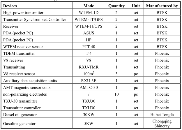
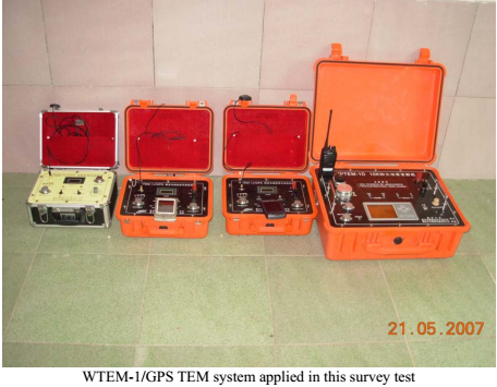
Purpose of performing this survey is to study the layer of this mine region within 400 meters deep, and the formation and active development of the deeper karst rock, water-accumulated karst rock and water-inrush fault. To ensure survey quality and compare the performance of different geophysical instruments, we applied two set of system in doing this investigation, one is a WTEM-1/GPS TEM system designed by Chongqing Bengteng Digital Control Technology Institute (BTSK), and the other is a V8 multifunction electrical resistivity instrument designed by Canadian Phoenix. Therefore, we can compare performance of and data acquired by these two systems which are obviously different in functions, working methods and different in data processing software, but analyze the data of the same region. Detailed information of these two systems is listed in the following table (Table 1).
Table 1 Configuration of WTEM-1/GPS system and V8 system
WTEM-1/GPS TEM System--- Large Loop Method
1. Working Conditions
-
Transmitter coil: 300×360m single-turn
-
Receiver coil: 2×2 m 100-turn
-
Transmitting current: 20A ~ 26A
-
Transmitting frequency: 32Hz (deep time window)
-
Stacking time: 32
2. Inversed Cross-section
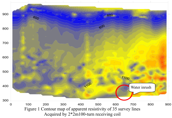
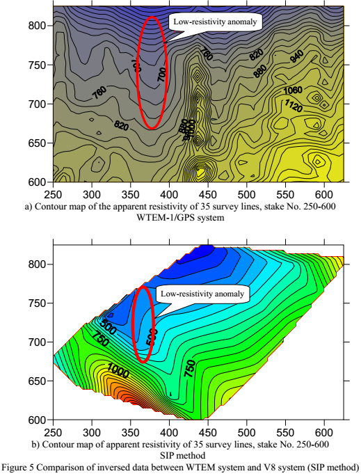
Figure 1 is a contour map of apparent resistivity acquired with 35 survey lines.In general, the reflected geology of this region is good. It is especially clear at the location of the known data points (the water inrush of the well, stake No. 35-650, about 350m deep), the reversed resistivity data map is nicely reflecting the actual geology, and the electrical property parameters are basically coherent to the previously acquired data.
V8 Multi-Function Electrical Sampling System--- CSAMT Method
CSAMT is short name of Controlled-Source Audio Frequency Magnetotelluric.
1. Working Method
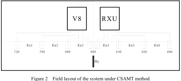
This CSAMT sampling field work is executed in June 24 th 2007. The tested profile is No. 35 survey line, between stake No. 480 and 720. Length of the profile is 240m, distance between the Current electrode A and B is 1870m, space between receiver and transmitter is 6318m. For field layout of the system, please refer the following figure (Figure 2).
2. Working Conditions
-
MN space: 20m
-
Transmitting current: 16A
-
Receiving channel: 6
-
Transmitting frequency: 7680~0.125Hz
3. Measured Data Comparison
Pre-process the original data with the CMTPro software equipped by PHOENIX, and then process the data with CSATM-SW software. The final results are as shown in Figure 3 (below).
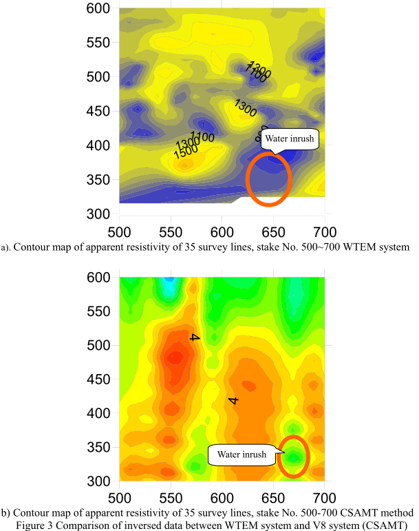
Figure 3a is part of Figure 1, enlarged. From these two figures (Figure 3a, 3b), it is known that the property of the underground materials inversed by the Bostick mode are relatively coherent to that reflected by the WTEM-1/GPS system, high resistivity and low resistivity are corresponding, and the already know data points (water inrush) reflected by both are also coherent. The larger difference between the two set of data is electrical property (apparent resistivity), for the working method applied and mode for data processing are different. Despite this point, relative relation of the two data is basically the same. In a word, results of these two different system and different method are good in coherence.
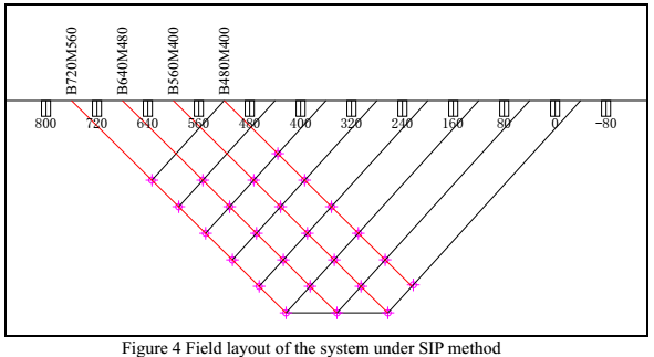
V8 Multi-Function Electrical Sampling System--- SIP Method
SIP is short name of Spectral Induced Polarization method.
1.Working Method
This SIP sampling field work is executed in June 25th, 2007. The tried-on profile is of No. 35 survey line. Receiving channel applied is 6, in all carried out 4 arrays (Figure 4).
1.Working Conditions
-
Dipole moment: 80m
-
Initial isolation coefficient: for array B480M400, it is 1; for other arrays, it is 2.
-
Coefficient of length of transmitting dipole: 1
-
Receiving channel: 6
-
Transmitting current: 8A
-
Transmitting frequency: 256~0.015625Hz
2.Inversed Data Comparison
Pre-process the original data with the SIPPro software equipped by PHOENIX, and then process the data with SFIPX-SWV2.0 software. The final inversed results of IP apparent spectral parameters are as shown in Figure 5b). According to the data analysis of the WTEM-1 system, we known that, between stake No. 350~400, at 750m deep, there is a low-resistivity
Conclusion
According to the above tests and analysis, we generally have ascertained a set of technical parameters and information that matchable to the local geology, and that the data surveyed by the WTEM-1/GPS TEM system by BTSK is adopted.
The above information of technical parameters and working methods are based on a serial of survey tests. They are evidence of the reasonableness of the parameters. With assistance of the already known information, this survey test has reached its purpose. Further more, through this survey test of the two systems and different methods, transient electromagnetic (TEM) system is proved once again that it is scientific and efficient.
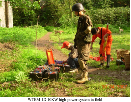
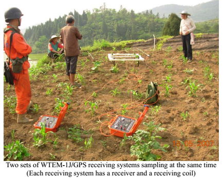
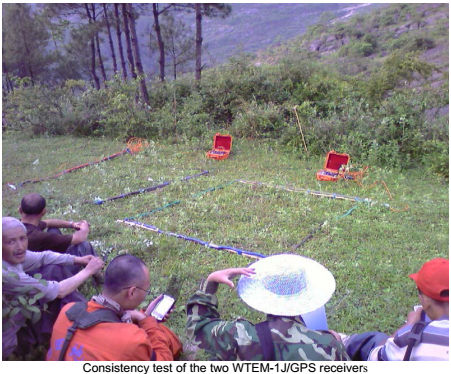
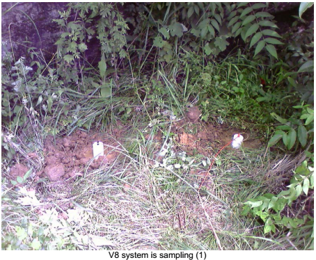
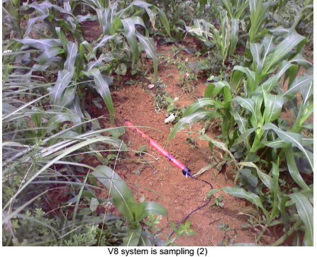
Field Photos
 ENGLISH
 Chinese
 Russian

